 SA
SA  KW
KW  IE
IE AU
AU UAE
UAE UK
UK USA
USA  CA
CA DE
DE  QA
QA ZA
ZA  BH
BH NL
NL  MU
MU FR
FR 


To improve efficiency and obtain faster and better drones for crop scouting, many farms around the globe are embracing Animal counting technology. Livestock applications can be used for precision agriculture, but they also work well in livestock farming, which is often overlooked by AI drones.
This blog will focus on some of the most innovative applications of Animal counting technology in livestock production and management and how it is changing how drones for livestock management are done.
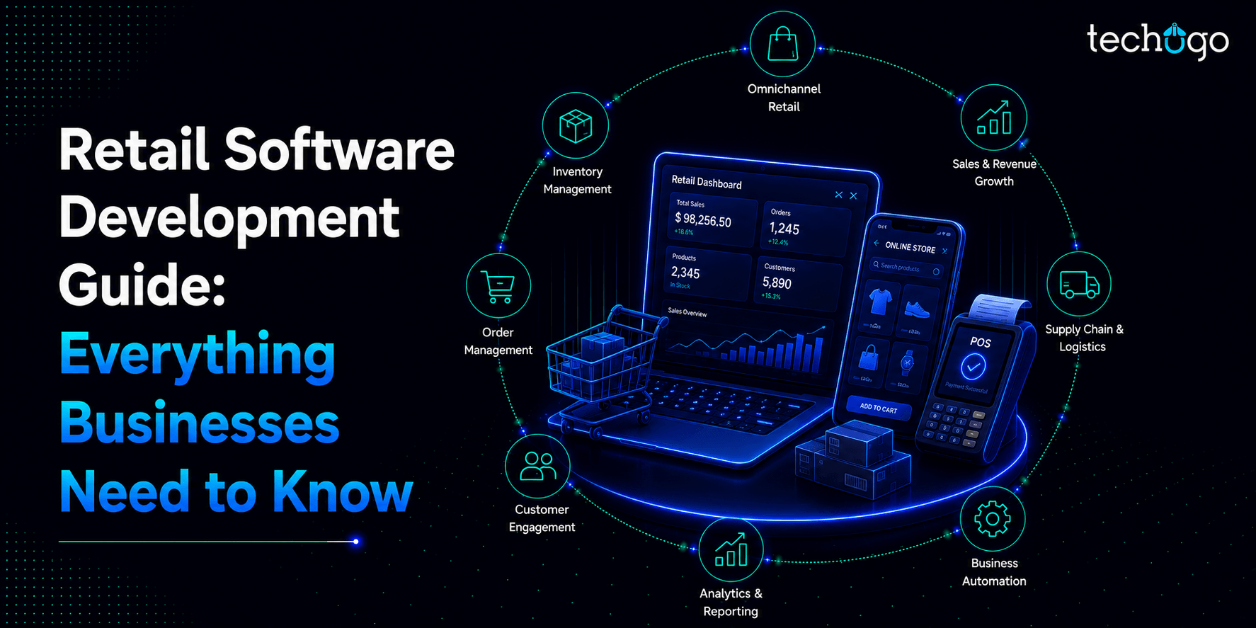
Drones for Livestock Management
Drones are rapidly gaining popularity in the crop production industry. Farmers use drones to spot weeds, pests, and other nutrient deficiencies. Although drones are still being adopted slowly in cattle production, they will be more famous for drones for livestock production management. Drones can be used to help their ranches from far away. These are just a few of the cool things that drones can do.
Drones for Cattle Farming
One of the most exciting uses of drones in cattle farming is that they can remotely check water supplies and determine where cattle are located in remote canyons.
Drones can also identify densely grazed areas, cedar tree thickets, and other vegetation without traversing the entire pasture. In addition, drone images can be used to determine where to place fences or where to move cattle.
Drones for Cattle Herding
The beef industry is looking at the possibility of using drones to herd cattle. Farmers can use a drone service equipped with a camera to locate their herds and then move them. This reduces the time required to move cattle. The drone will hover over the cattle, and they will run away from it. However, they don’t seem afraid of the drone’s sound and will move gently.
Sometimes, cattle will move out of the pasture and leave their herd. It is essential to find them and return them to other animals. The drone can be used to direct stray animals in the direction that you wish them to go. This can be very helpful in places where it is difficult to reach.
Drones for Cattle Monitoring
There are many other uses for drones in cattle management. Drones can be used to monitor cattle. Drones can also be used to inspect cows for their health. Ranchers won’t need to be out in the field all day. It would be done by drone.
Cattle counting drones are an excellent tool for managing the daily herd count.
Farm Security
Farmers can have a 360-degree view of their land by placing cattle drones that provide consistent information from remote locations. Farmers can use drones to identify illegal activities and trespassers. Drones can also be used to investigate potential disturbances, which reduces the time it takes to respond and keeps farm workers safer.
Also Read : Seeding the Future of Agriculture in Saudi Arabia: An AgriTech Boom
Best practices for drones in agriculture
Drones are becoming more popular for precision agriculture because they can deliver timely and efficient information. Drones are being used more because of swarm drone software advancement and affordability. Let’s look at drones in agriculture.
1. Estimating soil condition
Smart farming uses data to empower farmers to make informed decisions based on precise information about soil conditions. Previously, this data was collected manually and required physical field visits. A Drone detection app is equipped with intelligent sensors for agriculture and can collect and deliver data. They can also be more precise and faster.
2. Future crops to plant
A drone can plant seeds in the soil instead of using old methods. Although drones are relatively new for seed planting, many drone app development companies are trying this method.
Drone Seed, for example, is a startup that uses drone technology to plant crops. Unscrewed aircraft can spray crops with water, fertilizers, or herbicides. This reduces labor costs and time.
3. Combating pests and infections
Using hyperspectral, multispectral, and thermal technology, drones can inform farmers about soil conditions. They can also detect areas infested with weeds, insects, and other pests. This data allows farmers to determine the right amount of chemicals to combat problems and reduce costs.
4. Spraying agriculture
Smart farms also make use of drones to spray crops. This helps reduce human contact with pesticides, fertilizers, and other harmful chemicals. Drones can do this job faster than planes and vehicles, and they can also be used as an alternative for farmers who still use manual labor.
Spot treatment is also possible with drones. Drones can spot and treat infected areas using sensors and cameras. They also leave the healthy room intact. This saves time, increases safety, and reduces expenses.
5. Crop Surveillance
Large areas of agricultural fields make it difficult to assess the crops’ state accurately. However, drones can use agriculture mapping software and provide information that farmers need to know about the health of their crops.
Drones are used to inspect fields with infrared cameras and determine light absorption rates. This allows for an accurate estimation of the crop’s state. As a result, farmers can change their plants’ condition based on real-time, accurate information.
6. Livestock monitoring
Drones can monitor livestock farms and reduce the use of horses and trucks. Drones have thermal sensors to locate lost cattle and detect sick or injured animals. They can also calculate their exact numbers. Drones can do a better job of cattle surveillance than herding dogs.
Also Read : AI in Agriculture: Discovering the Role of Artificial Intelligence in Agriculture Projects
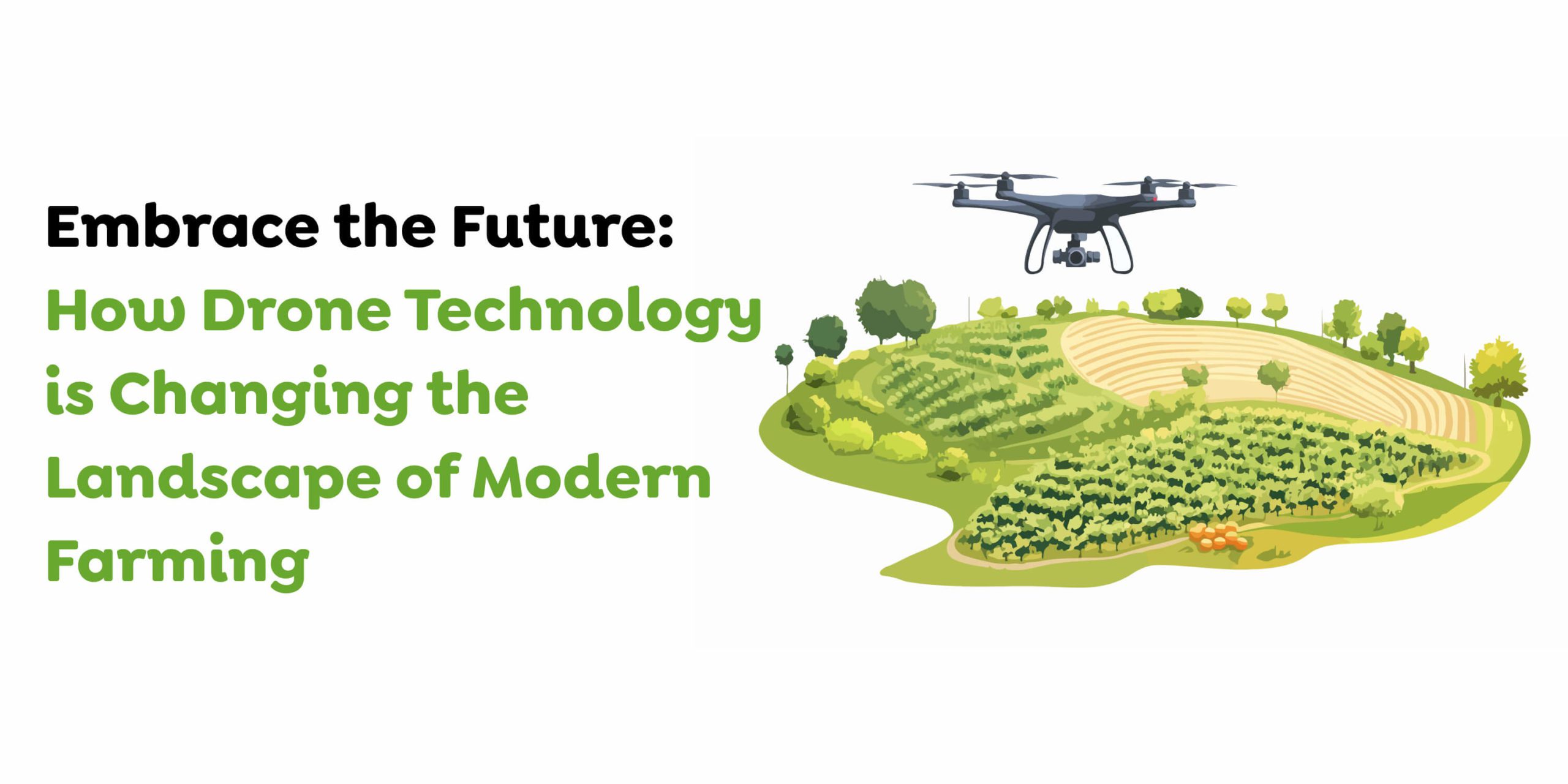
The constantly changing world of agriculture
Today’s farming operations are quite different from those of a few decades back. The latest technology allows growers to optimize every aspect of their operation, from field spraying to crop health and grow cycles to maximize yields.
Drones and other unscrewed aerial vehicles (UAVs) are significant factors in this transformation. For example, a drone for agriculture mapping allows farmers to access detailed data analysis, mission planning, and new tools that can handle physical work.
The two main benefits of the UAV and its payload are crop spraying efficiency and field mapping.
Spraying a field using a UAV
DJI’s Agras series of spraying drones can precisely accomplish the following:
- Fertilizer
- Herbicide
- Fungicide
- Pesticide
- Seeds
- Desiccants
Any grower will face a constant challenge in ensuring that the above are applied efficiently. Spraying too concentrated in one area can increase costs and lower quality. However, a concentration that is too low can make your crops more susceptible to malnourishment, overgrown, or eaten by insects or other predators. This could reduce the yield rate.
Suitable drones for farming and spraying payloads can distribute chemicals efficiently and evenly.
What are the results? The results? DJI drones can be used on almost any crop, including cotton, rice, wheat, corn, and citrus trees.
Drone spraying can cover more ground at a lower cost and provide significant environmental benefits. Drones can distribute pesticides more efficiently, so you can use fewer pesticides for the same effect. UAV seeding is another way to maximize your land’s efficiency. Effective land use is crucial to success in the future, with climate change expected to reduce the global land available for drone agriculture applications.
Drones are used to collect data for precision agriculture
Intelligent spraying and seeding aren’t the only way to improve agricultural efficiency, reduce costs, or increase yields. Drones can map an area and provide new insights, taking much guesswork out of the growing process.
Remote sensing modern technology is vital to this. It picks up radiation from the ground and can track everything, including physical characteristics and heat generated. Multispectral imaging is a feature of the best agricultural mapping drones. They can capture both visible and invisible light sensors within a defined range. This drone can create two types of maps:
1. RGB maps: This is a birds-eye view, but a basic red-green-blue map (RGB) can provide new information. These maps can help you determine how much land you need to grow and deliver crop monitoring over an extended period. This will allow you to adjust from season to season.
2. NDVI maps: The Normalized Difference Vegetation Index or NDVI (Normalized Difference Vegetation Index) extends the insight of an RGB map. This map displays the amount of infrared sunlight reflected in an area. This is an indicator of drought and malnourishment. It is an invaluable tool for farmers who want to predict their yield rates accurately.
Also Read : Unlocking GIS App & Software Development: Your Ultimate Business Guide!
Automating Programmable Drones for Livestock Management
Drone automation could save ranchers many trips and hours of labor. An autonomous drone can fly independently and record video according to a predetermined route and schedule. This is just one use case of drone automation.
Tech entrepreneurs are looking for ways to automate the movement and monitoring of cattle using programmable drones.
Automate the process by putting an RFID tag on every Animal. This can be used to read and locate each Animal utilizing a drone.
A programmable drone with computer-aided vision can locate stray animals in pastures and then move them toward the rest of their herd. A rancher can also use the drone to find a specific animal or check its condition by entering an RFID number.
A programmable drone could also be used to assist with rotational grazing. Rotational grazing allows only one pasture area to be grazed at once while the rest of the range remains ungrazed. The drone detection app can be programmed to detect which part of the pasture was scratched and move the herd to the next paddock. The rotation timing can also be adjusted based on the stage of forage growth. This allows forage plants to replenish energy, build vigor, deepen roots, and provide long-term maximum production.
All animals, large and small – drones to monitor livestock
Monitoring the location of cattle and sheep is labor-intensive because they spend long periods in the country’s fields, pastures, hills, and moorland.
The traditional tracking method relies on human observation. It can identify animals by their natural characteristics like color and breed or mark and identify individual animals using artificial means such as colored collars or tags. However, this method is susceptible to observer error as well as fatigue.
A drone for surveillance, equipped only with a camera, can provide an autonomous remote method for shepherds and farmers to track livestock movements. This allows them to monitor the stock from their kitchen tables.
However, this power is significantly increased when you add other technology like sensors, GPS location information, and animal identification systems.
UAVs can be used to monitor and track livestock.
Multi-UAV systems may perform any or all of these functions.
- Cameras facing down to monitor motion and orientation in livestock herds.
- Thermal infrared imaging cameras locate the location, especially in dark areas, undergrowth, and woodlands.
- GPS collars fitted to an animal with GPS-equipped collars can be used to find specific locations.
- Systems for livestock identification
Precision Livestock Farming is a way to manage individual animals by continuously monitoring their welfare, production, and environmental impact.
UAVs will initially cover the entire area of a livestock monitoring program, including the field, pasture, or greater, to locate all the animals. These data can be used to identify livestock density, clustering, and plotting movement.
Current drones are limited by battery limitations, which can restrict their flight time. However, the ag mapping software can track and analyze livestock movements, location, and movement to reduce “flight time to an animal.” This maximizes drone efficiency and minimizes flight times and distances from base to Animal, Animal, and Animal, and herd-to-herd and back again.
The UAV would fly again and continue to monitor animal movements after the initial sweep. Furthermore, you can download the data for analysis, tracking, and comparison.
Drones can also use facial recognition systems to identify specific animals.
Field Security Monitoring for Animal Counting
Field security monitoring is another simple but highly effective application of livestock Management drones.
Most livestock ranchers and farmers have received a terrifying phone call informing their animals that they are on the loose. So, of course, the first thing you should do after receiving such a call is remember whether you shut down the gate. But regret cannot undo the damage done.
Farmers and ranchers can still keep up with field inspections from their homes by using AI drones. Today’s powerful drone technology driven by disruptive technologies can fly across fields and capture and send back real-time video footage. This dramatically reduces the time and effort required to maintain field security while minimizing the loss of livestock due to negligence. In addition, it allows farmers and ranchers to identify any field repairs that are needed quickly and to take prompt action to reduce the risk of livestock loss.
1. Monitoring animal welfare
Managing the health of animals takes work for farmers/ranchers. Unfortunately, it is almost impossible for livestock farmers to maintain critical animal welfare.
AI-powered drones are capable of doing this tedious task quite easily.
Modern Artificial Intelligence drones have robust cameras/sensors that can capture livestock images in various modes. In addition, AI drones can be fitted with thermal sensors to monitor the temperature of the animals in the field. These sensors can automatically process imagery and notify farmers and ranchers of any abnormality in body temperature. They use proven AI/ML algorithms and image processing technologies. This helps to reduce the time and effort needed to monitor and manage animals’ welfare. It also minimizes the risk of animal death by identifying sick animals via heat signatures.
2. Drone operation by automated drones – taking technology one step further
Today, farmers and ranchers are virtual pilots who control drone flights for all the above use cases. However, technology is rapidly changing. Robust AI drones can now take automated flights around the field perimeters and perform desired tasks with minimal human intervention. In addition, you can pre-program AI drones to fly across fields periodically for specific purposes. This will allow you to keep up with drones for livestock management tasks and prevent losses from inefficient management.
Also Read : Mobile App Development in the Middle East: 2025 Trends & Success Stories
How an App Development Company Can Help You Build a Drone System
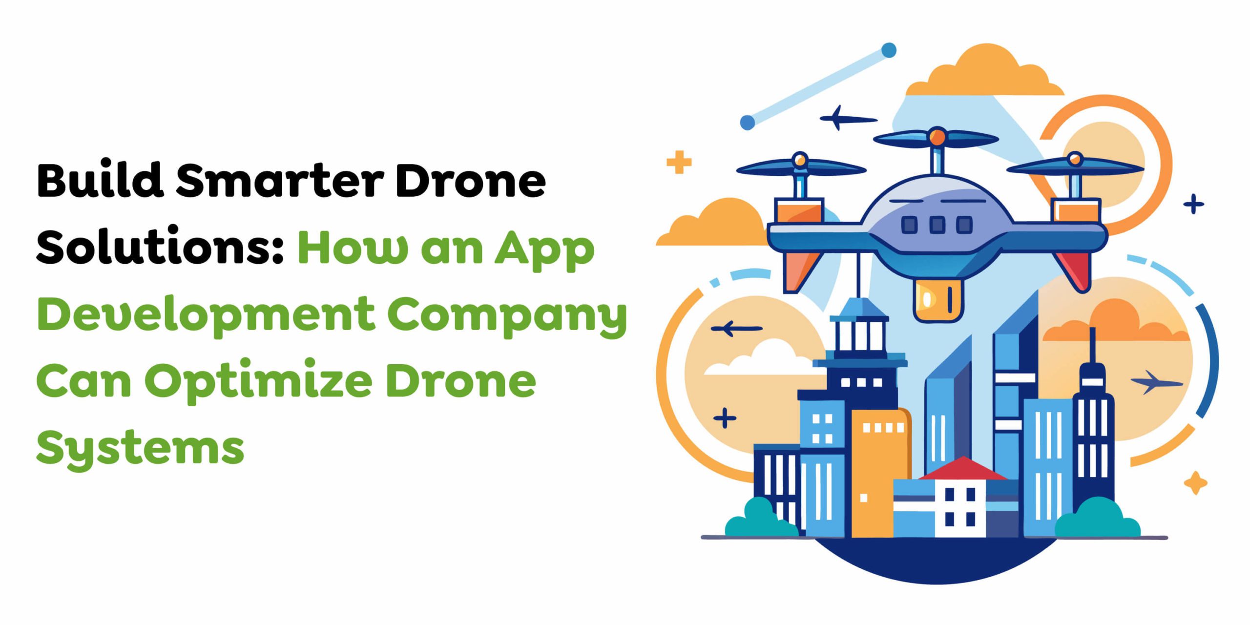
An iOS app development company is crucial in building and enhancing drone systems by developing specialized software to ensure efficient operations, seamless control, and advanced analytics. Here’s how they can help:
1. Custom Drone Control Software
App developers can create tailor-made software development to control and monitor drone operations. These solutions may include:
- Real-time navigation systems.
- Geofencing to restrict drone movements within specific areas.
- Pre-programmed routes for automated flights.
- Intuitive flight controls for seamless user experience.
2. Data Collection and Advanced Analytics
Drones generate a wealth of data and app development companies can:
- Design apps that process and analyze data from drone cameras and sensors.
- Implement AI and ML algorithms for object detection, animal counting, crop health analysis, and pest identification.
- Develop real-time dashboards to present insights in a user-friendly format.
3. Integration with IoT and Sensors
App developers can integrate drones with advanced IoT devices and sensors, enabling functionalities such as:
- GPS tracking for precision navigation and location identification.
- Thermal or multispectral imaging monitors livestock health or analyzes soil conditions.
- Real-time synchronization with cloud platforms for seamless data sharing.
4. Automation and AI-Powered Features
Modern drone systems require automation, and drone app development companies can:
- Build software to automate livestock herding, crop spraying, or surveillance.
- RFID integration should be included to track and locate animals or assets efficiently.
- Use computer vision for object recognition and dynamic route adjustments.
5. User-Friendly Interfaces and Cross-Platform Compatibility
To ensure usability, app developers design intuitive interfaces that:
- Provide easy access to drone controls and analytics dashboards.
- Offer cross-platform compatibility, making the app accessible on mobile devices, tablets, and desktops.
- Include real-time notifications and alerts for emergencies or updates.
6. Real-Time Monitoring and Alerts
Developers can enable drones to send real-time alerts about critical issues such as:
- Livestock health abnormalities detected by thermal imaging.
- Security breaches or trespassing on farmland.
- Weather changes impacting drone flights.
7. Cloud Integration for Remote Access
With cloud technology, app development companies can:
- Enable remote access to data and drone controls.
- Provide secure storage for images, videos, and operational logs.
- Facilitate seamless collaboration among multiple users.
8. Scalability and Future Upgrades
AI App development companies ensure that drone systems are:
- Scalable to accommodate multiple drones or new functionalities.
- Capable of receiving regular updates for improved performance and security.
9. Compliance with Aviation Regulations
Developers can integrate features to ensure compliance with legal requirements, such as:
- Automatic no-fly zone detection.
- Built-in reporting mechanisms to track flight activities.
- Safety protocols to prevent unauthorized drone usage.
10. Cost Optimization Through Efficient Operations
App developers can optimize drone operations by:
- Reducing manual intervention through automation.
- Improving fuel or battery efficiency with more innovative navigation algorithms.
- Offering predictive maintenance features to avoid operational downtime.
11. Enhanced Security Features
To prevent unauthorized access or misuse, app developers can:
- Integrate user authentication systems.
- Include encryption protocols for secure data transmission.
- Provide tamper-proof logging of flight activities.
How Techugo Makes App Development Easier for You
Our top mobile app development company, Techugo, provides full-service drone app development that takes your project from conception to release while keeping the process easy and effective. Our group builds tailored digital products that deliver an intuitive design with advanced technology against future growth needs. Our agile procedures help you stay nimble with your evolving requirements so we can get your product to market quickly. Our team delivers app development with practical security solutions, affordable fees, and complete support services, making everything easy.
Get in touch right now to transform your app concept into a functioning product.
Final thoughts
Modern farming can be transformed by agricultural drone technology in many ways. First, however, farmers must prepare well to reap the full benefits of drone technology. This includes estimating their business goals and deciding on the right hardware stack and ag mapping software features.
Overall, the development of agricultural drone technology is complex and will require partnerships with reliable ag mapping software solutions providers. Just connect with Techugo for more information.
Get in touch
We'd love to hear from you.