 SA
SA
 KW
KW
 IE
IE AU
AU UAE
UAE UK
UK USA
USA
 CA
CA DE
DE
 QA
QA ZA
ZA
 BH
BH NL
NL
 MU
MU FR
FR


After the I/O conference, Google has brought many applications and functionalities in the existing ones. One of them is Google Maps. This application has got a groundbreaking transformation.
Don’t you want to know what is that transformation? Have any clues?
No?
Well! Google Map has got a disaster SOS alert update.Yes! You hear me correct it is SOS alert.
How does it work?
Don’t fret, let’s know about it.
THE TALE OF GOOGLE MAPS WITH NATURAL DISASTER FORECAST
Danish brothers, Jens and Lars Eilstrup Rasmussen created a C++ program that later recognized as Google Maps, as the company acquired it in October 2004. Since then, the company has brought several updates and enhancements in this application.
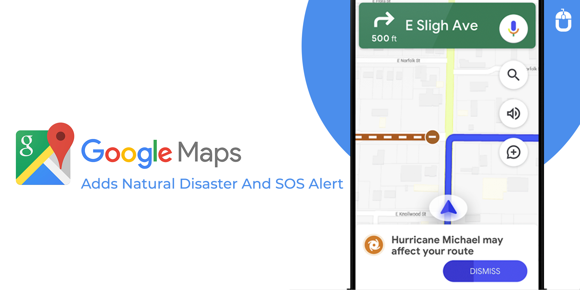
Lately, it has integrated speeding limit and speed camera alerts and now it is ready to surprise users with a new feature. That will affect the overall use of Google Maps. Though, the groundbreaking feature of disaster forecasting will improve SOS alert by offering a better and more detailed visualization warning about floods, hurricanes, and earthquakes.
This is not the first that the company took initiative to offer SOS alerts. And owing to that Google Maps application alerts are already having a summary of whatever is happening, emergency phone numbers and websites, relevant stories for the incidents, and updates from the local authorities.
But this was never enough. So the company has brought a new feature. That will show detailed visualization about the natural disaster before the incident hits the area near to them or the expected area. In this, a card linked to a hurricane forecast cone, shows the prediction on the course of the storm and the expected time of hitting the particular location.
GOOGLE MAPS CRISIS ALERT SYSTEM
Don’t you know that Street View is the most popular and appreciated feature of Google Maps? But! the application also has very useful tool named as SOS alert. Most importantly, the main purpose for creating this tool was to give warning about the disasters during the time of crisis.
Google determined that this new update can help people in seeing a “crisis notification card” when the disaster hits the area. For instance, if a storm is about to come in your area, Google Maps warning will give you the forecast about the trajectory of the storm with the time of expected arrival in the region. This will help people in taking required actions immediately.
Altogether, Google Maps users can also upload the graphic. This company will release this new feature later this summer.
In addition, this application will feature the flood forecast and will indicate the place where flood is going to take place. Besides, it will feature likely severity in the different regions. The app has also got many other features so take a look at them.
UPDATES IN GOOGLE MAPS
Here are the updates that Google Maps has got this year:
Live Location Sharing
Now you can share your live location with your friends and family with the help of crisis notification card. And! you don’t need to think about time duration as you can share your location for an unlimited time.
Safety From Road Blockage
Another functionality that this application got is road blockage closures. Basically, now you can see road closures by simply turning on the traffic layer. Altogether, you can share the road closure nearby and the one recently encountered. This is not done, besides you can also confirm the current situation of the road that it is blocked or not by some simple touch on Android.
Sharing Disaster Information
Another functionality that makes the application really useful is sharing disaster information directly. With this feature, you can inform your friends and family about the most recent situations by just touching the share button on the crisis card. Thereby, everyone whom you want to tell about the crisis and can redirect them to Google Maps.
And they can see the information about the relevant crisis. Altogether, they can see the emergency contact numbers, visualizations, summary and a lot of aspects that can help them in taking required actions.
Indeed, these functionalities are astounding and can improve user experience at a great extent. However, Every day various top mobile app development companies are developing different types of features to offer users more enhanced and upgraded applications. To know more, get in touch with us.
Get in touch
We'd love to hear from you.